26-11-24 // NEW PROJECT: ALONG THE GREEN AXIS Finalist
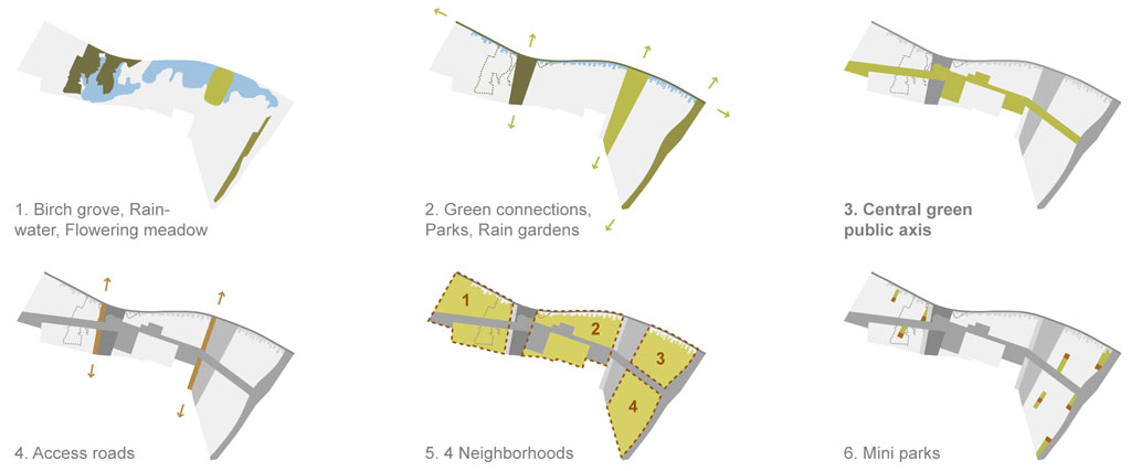
From the existing birch grove to 4 different neighborhoods
Green Connections, Rain Gardens and a Central Green Public Axis
We consider the landscape elements of the district, such as the birch grove, the rainwater and the flowering meadow, as identity-forming for the new “urban village”. They are therefore preserved and green connections, parks, rain gardens and a central green public axis are created from them, which structure the area and create together with 2 new access roads 4 different neighborhoods with mini parks.
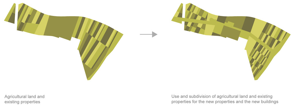
Agricultural fields shaping the lots
Agricultural Land and Properties
The various landscape elements, together with the urban infrastructure, will create a special “urban village” atmosphere in the area. Since the existing agricultural areas and properties also give the district its own identity, we want to use them to organize the future properties and buildings. This makes sectional development with smaller building plots particularly easy.
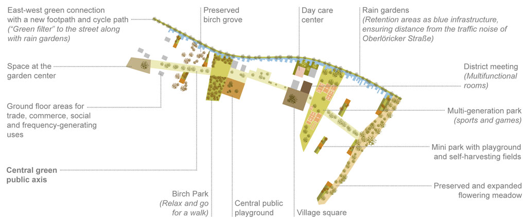
Landscape Elements
Birch Park, Multi-generation Park and Flowering Meadow
The most important landscape element will be the central green public pedestrian axis. All other elements, such as the birch park, the multi-generational park, the western square at the garden center, the central public playground and village square and the eastern extended flowering meadow, are attached to it. In the north there will also be a “green filter” to the street with a pedestrian and cycle path and rain gardens as retention areas.
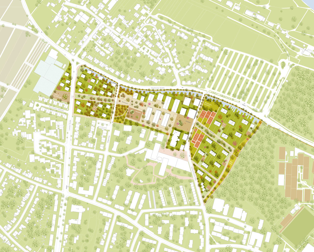
Site
4 neighborhoods
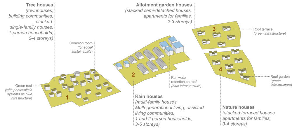
Tree Houses, Rain Houses, Allotment Houses and Nature Houses
The shape and density of the neighborhoods should remain flexible. Nevertheless, we propose the following space-saving and accordingly “urban village” typologies, inspired by the landscape, with new forms of housing that adapt to the existing buildings: “Tree houses” as town houses; “Rain houses” as apartment buildings; “Allotment garden houses” as stacked semi-detached houses; and “nature houses” as stacked terraced houses.
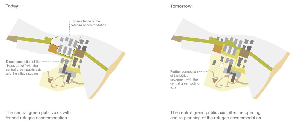
Long-term strategy for the refugee accommodation
Flexible Strategy with and without the Integrating of the Refugee Accommodation
Since the future of refugee accommodation is uncertain, we are presenting a strategy that will enable our planning before these accommodations are over-planned and opened. In this case, the connecting green public axis can run south of the existing fence and also connect the “Haus Lörick” directly to the village square. If it is opened, the axis can then run through the middle of the district.
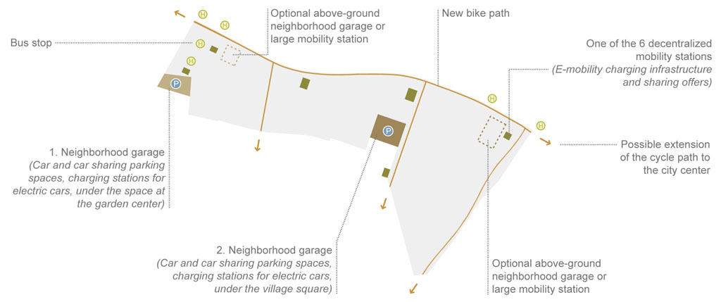
A car-free district
New Cycle Path Network and Future-oriented Mobility
A new cycle path network will be created for a largely car-free district with short distances, which will connect the area in all directions and can be expanded. A network of footpaths, residential paths and play streets will complement the cycle path network. Mobility stations, decentralized or central, should be built near the bus stops. Neighborhood garages will be possible both above ground on the edges and under the squares.
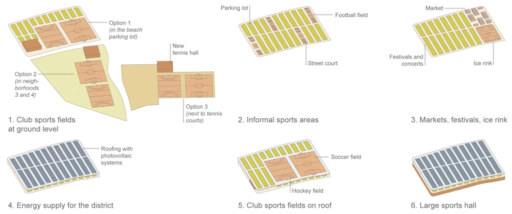
Sport fields and energy production
Club Sports, Beach Parking Lot and Connection to the Rhine
The beach parking lot could be used for club sports fields and the tennis hall. These uses are also possible in the new neighborhoods. Since they are using a lot of space there, we recommend placing them east of the planning area. In order to continue to make parking possible in the beach parking lot, informal sports areas, markets, festivals, ice rinks, roofs or a large sports hall could be created as a link to the Rhine.
Title: Along the Green Axis
Project: New Perspectives for Lörick
Date: November 2024
Type: Limited 2-phase urban and landscape design competition
Organizer: City of Düsseldorf, Germany
Location: Düsseldorf, Germany
Site: South of Oberlöricker Straße in Düsseldorf Lörick
Programme: Housing, landscape, public spaces
Surface: 10ha
Status: Competition
Awards: Finalist
Team: Bernd Upmeyer, Anna Halek, Silvia Lupini (LOOP, landscape)